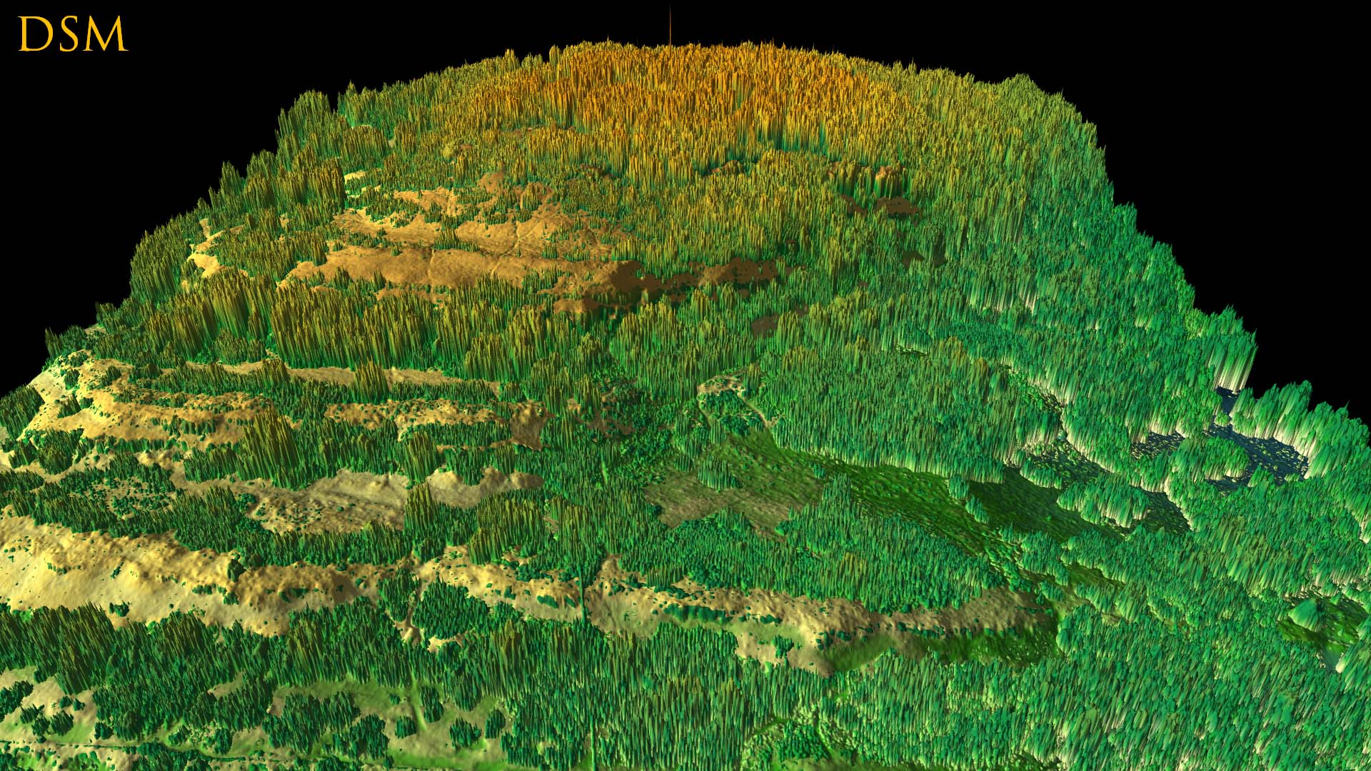
Shallow aerial LIDAR view of Warton Crag escarpments and summit looking from the South. This is the Digital Surface Model (DSM) view, i.e. includes trees and other vegetation etc, so historic features largely hidden. (Image produced in 2017 by David Ratledge).

No Comments
Add a comment about this page